Mount Carrigain is part of the 4,000 footers in New Hampshire. Mount Carrigain is located Grafton County, NH. The mountain is named after Phillip Carrigain, NH Secretary of State (1805–10), and is on the south side of the Pemigewasset Wilderness. There are two main paths to the summit. Desolation trail, which is steeper can be accessed by Carrigain Notch Trail, Nancy Pond Trail and a few other trails. The other option is Signal Ridge Trail, not as steep but still a rough terrain with a steep incline. Signal Ridge Trail can be accessed by Sawyer River Road off of Route 302. *Note: Sawyer River Road is closed during the winter months* We took Signal Ridge Trail, which can be found two miles from turning onto Sawyer River Road from Route 302. The trail is on the right just after a bridge with the parking on the left. In the parking lot area you will see this gem of a tree.

The trailhead…

Note: The trailhead sign misspells “Carrigan”. AMC Link From the trailhead to the junction the trail is rather easy and a pleasant walk minus the mosquitoes. I suggest bringing some repellent. We allowed M to walk some of trail at the beginning because it was that easy.

About 1.5 miles into the hike you will have to cross the river. At the beginning of the spring season this crossing could be extremely difficult or impassable. After the river crossing, you have about 0.2 miles to the junction. You will cross some log bog bridges heading to the junction.

At this junction you can either head left to continue Signal Ridge trail or head straight on Carrigain Notch trail. We went left, on Signal Ridge trail and shortly into trail is where the terrain became harder. From the junction, it is 3.3 miles to the summit of Mount Carrigain. The trail offers nothing exciting other than incline and rocks. In some ways, it feels like you are on a ‘death march’ to the summit. But, do not worry the views at the top are amazing and even more amazing on a clear day.
If you hike this trail during rain or after take your time with the climb some careful footing is needed especially when the rocks are wet. There is a section of this hike that is pure rock; not large rocks, but those pesky little rocks. Watch your footing, especially on descend.
Here is a small ‘rock climb’ you will face. It’s rather easy, but with larger backpacks or a small child on your back it will take some maneuvering.


Though, there is really no views or excitement to the summit. There are locations were you get what our family “sarcasm” calls “outdoor a/c”. In other words, you will hit areas, where a nice breeze with come through. Of course, that is more towards the ridge line and summit, but on hot days like our hike, we are thankful for what we are given.
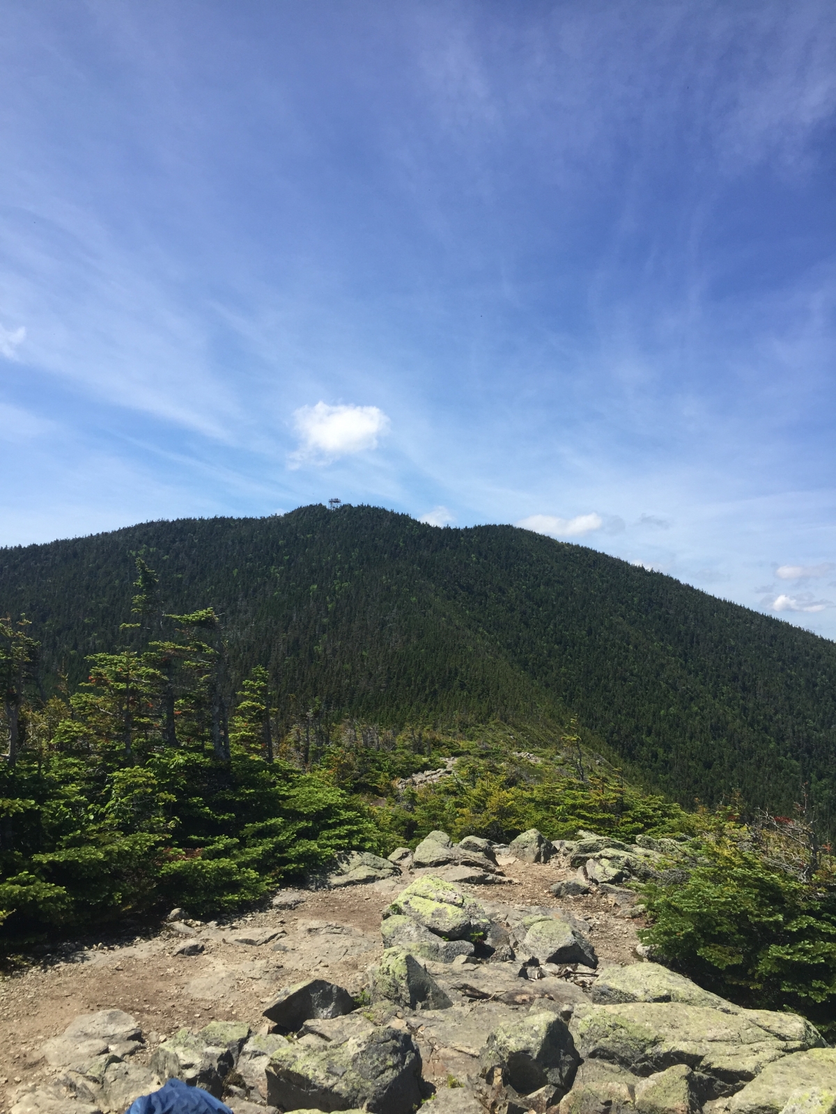
You will reach the Signal Ridge at the 4.5 mile marker. You will know its the ridge because straight ahead of you about a half mile away is the summit of Mount Carrigain and the fire tower, to your left you will be some shrubs and trees and to your right you will see the Presidential Range, Attitash Mountain and on a clear day into Maine.

**Note: Fire towers or lookout towers provides housing and protection for a person known as a “fire lookout “. It provides housing for those on duty searching for fires. Now a days, it is done by airplane. So, when you climb up, think about those that lived and did their job to keep the forests and wildlife safe in the early 1900s. **
The ridge is a great place to take a moment, rest and regroup. The trip up to the summit is short and after your ‘death march’ climb, its really nothing. But remember what goes up must go down. Here are some images from the ridge and summit.


Here are some terrain images by our GPS device. These are after the junction post approaching the ridge and summit.


Over all this is a great hike. It is a workout, but well worth all of it.
Mount Carrigain in our books, lives up to its name of one of the most un- respected climbs and views of the White Mountains.
Happy Trails!
