Mount Osceola is a 4,315-foot peak, located in the White Mountain National Forest, New Hampshire. Mount Osceola is named for the early-19th century Seminole leader.
There are two ways to reach the summit of Mount Osceola. One is from Greeley Pond Trail to the northeast of the mountain, which requires crossing the East Peak of Osceola first or from Tripoli Road to the south. We took the southern ascent via the Mount Osceola trail, which is a 3.2 mile/5k trek to the top, 6.2 mile/10k round trip.
The trailhead is off of Tripoli Road in Waterville Valley, NH. You can access the road off I-93 exit 31. *Note: this road is closed from November to May* Travel roughly 6.7 miles on Tripoli Rd to the trailhead. The trailhead is located on the left with parking. *There is a fee for parking for those that do not have a yearly parking pass.*. Tripoli road is paved then becomes a gravel a few miles into the woods. You will pass various camping grounds during the summer it is rather busy so be cautious.
Trailhead sign
The trail is one of the easiest we have done. There were not many areas that would be problematic for a family hiking with a child. It is a far cry from the ‘death match’ hike of Mount Carrigain, via Signal Ridge Trail. There are a few areas near the summit that you will enjoy a few views and good breezes. In addition, compared to Mount Carrigain the trail path is not so rocky and a good 3 feet wider in certain areas, which is helpful when allowing people to pass.
Here are some images along the trail to the summit.
Abby on the trailAbby on the trailThe girls on the trail
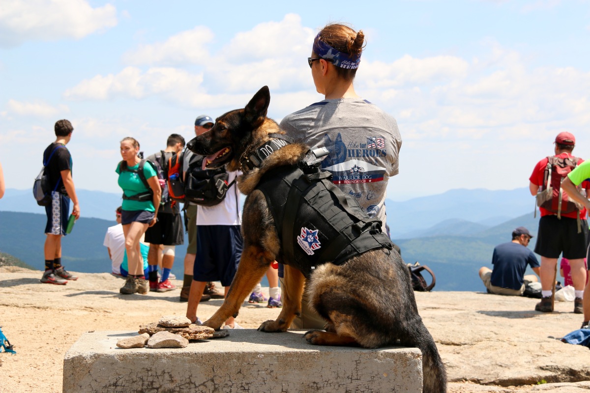
Our objective with this hike was to train Abby, our rescue canine. This trail is busy, very busy with people and dogs. The climb is rather easy but all the traffic of people and dogs is a great way to solidify training. There were “reactive” dogs on the trail, which was very helpful for training and a few people who were terrified of dogs. As I said, the trail is very busy and wide, which is great for real life training.
The trail is rather straight forward, a basic up and back with a few switch backs to keep the incline easy to handle. Some part of the trail are under reconstruction, but there are no hurdles to worry about.
Trail reconstruction sign
As you approach the summit, you will face some rock facings. A few of the facings the incline is rather step and can be very hazardous when wet. You can either go hand over feet or work your way along the side and up. I highly suggest to plan accordingly.
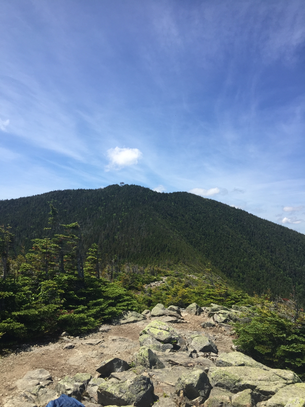
As you approach the summit there is a path to your left, climb up the rock and look out. You will be able to see Mount Washington and the Presidential’s on a clear day. Double back and take the path to the summit. The path to the right on your approach leads you to summit, too. We suggest skipping that path the approach from the path straight ahead is way better.
We were not able to find the summit marker for this mountain, but normally with fire tower mountains, we have found there are no summit markers.
If you are looking for an easy up and down with beautiful views this is your mountain. If you are hiking with kids it is definitely something you can do as a family and if you are traveling with a child on your back, it’s a walk in the park compared to other White Mountain trails.
Here are some summit images…
As usual, please remember to leave no trace especially in areas where bears are more prone. Safety first.
Mount Carrigain is part of the 4,000 footers in New Hampshire. Mount Carrigain is located Grafton County, NH. The mountain is named after Phillip Carrigain, NH Secretary of State (1805–10), and is on the south side of the Pemigewasset Wilderness. There are two main paths to the summit. Desolation trail, which is steeper can be accessed by Carrigain Notch Trail, Nancy Pond Trail and a few other trails. The other option is Signal Ridge Trail, not as steep but still a rough terrain with a steep incline. Signal Ridge Trail can be accessed by Sawyer River Road off of Route 302. *Note: Sawyer River Road is closed during the winter months* We took Signal Ridge Trail, which can be found two miles from turning onto Sawyer River Road from Route 302. The trail is on the right just after a bridge with the parking on the left. In the parking lot area you will see this gem of a tree.
Tree in parking lot.
The trailhead…
Trailhead for Signal Ridge Trail
Note: The trailhead sign misspells “Carrigan”. AMC Link From the trailhead to the junction the trail is rather easy and a pleasant walk minus the mosquitoes. I suggest bringing some repellent. We allowed M to walk some of trail at the beginning because it was that easy.
M on the trail
About 1.5 miles into the hike you will have to cross the river. At the beginning of the spring season this crossing could be extremely difficult or impassable. After the river crossing, you have about 0.2 miles to the junction. You will cross some log bog bridges heading to the junction.
At this junction you can either head left to continue Signal Ridge trail or head straight on Carrigain Notch trail. We went left, on Signal Ridge trail and shortly into trail is where the terrain became harder. From the junction, it is 3.3 miles to the summit of Mount Carrigain. The trail offers nothing exciting other than incline and rocks. In some ways, it feels like you are on a ‘death march’ to the summit. But, do not worry the views at the top are amazing and even more amazing on a clear day.
If you hike this trail during rain or after take your time with the climb some careful footing is needed especially when the rocks are wet. There is a section of this hike that is pure rock; not large rocks, but those pesky little rocks. Watch your footing, especially on descend.
Here is a small ‘rock climb’ you will face. It’s rather easy, but with larger backpacks or a small child on your back it will take some maneuvering.
Though, there is really no views or excitement to the summit. There are locations were you get what our family “sarcasm” calls “outdoor a/c”. In other words, you will hit areas, where a nice breeze with come through. Of course, that is more towards the ridge line and summit, but on hot days like our hike, we are thankful for what we are given.
You will reach the Signal Ridge at the 4.5 mile marker. You will know its the ridge because straight ahead of you about a half mile away is the summit of Mount Carrigain and the fire tower, to your left you will be some shrubs and trees and to your right you will see the Presidential Range, Attitash Mountain and on a clear day into Maine.
From the Signal Ridge to the summit of Mt. Carrigain fire tower
**Note: Fire towers or lookout towers provides housing and protection for a person known as a “fire lookout “. It provides housing for those on duty searching for fires. Now a days, it is done by airplane. So, when you climb up, think about those that lived and did their job to keep the forests and wildlife safe in the early 1900s. **
The ridge is a great place to take a moment, rest and regroup. The trip up to the summit is short and after your ‘death march’ climb, its really nothing. But remember what goes up must go down. Here are some images from the ridge and summit.
Mount Washington from Carrigain
Here are some terrain images by our GPS device. These are after the junction post approaching the ridge and summit.
Basic Map3D Map
Over all this is a great hike. It is a workout, but well worth all of it.
Mount Carrigain in our books, lives up to its name of one of the most un- respected climbs and views of the White Mountains.
As mentioned, a few blogs ago, M and I received an ‘upgrade’ on our backpack/kid carrier. We were using the Deuter Kid Comfort II, which you can read about it in a post I wrote, here. That post goes into some important items to think about, I will re-address some of them during this post, because they are worth repeating a few times.
*Note; Toddler is interchangeable with Infant*
First off, my suggestion to anyone trying to find a toddler backpack for hiking is to go to your local hiking/outdoor retail store and try every single one on with your toddler in the seat. Some store examples are Eastern Mountain Sports (EMS), REI, Gander Mnt, etc. I suggest calling ahead to make sure they have kid carriers at their location.
Also, make sure you have receive help from the store’s staff, they will know about the how to properly adjust the carrier for your toddler and fit the pack on you. What works for me, may not work for you. After trying several types on with M, again this year, we went with the Deuter Kid Comfort III. I have read some poor reviews over the pack. Most of the reviews, deal with not having the pack properly fitted for your child and/or you.
Lastly, I suggest thinking about what you will be hiking, how long and where. This will help you find the correct carrier and also help the store’s staff give you options.
I have absolutely no complaints with our Kid Comfort III (KC3). I have tried to find errors and things, I would want replaced or changed, but I can’t find have anything to complain about. For what we want, this pack is perfect. Every small issue, we had with the Kid Comfort II (KC2) has been improved. I am picky, very picky about things I purchase. With this pack, I have no buyer’s remorse…. none at all and that is definitely saying something.
Here is the link to Deuter’s site to show the pack — link. You can get all the information from them, but I am going to take you through the changes and why we love this carrier.
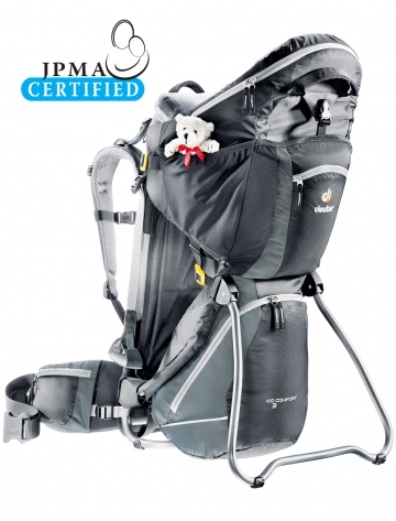
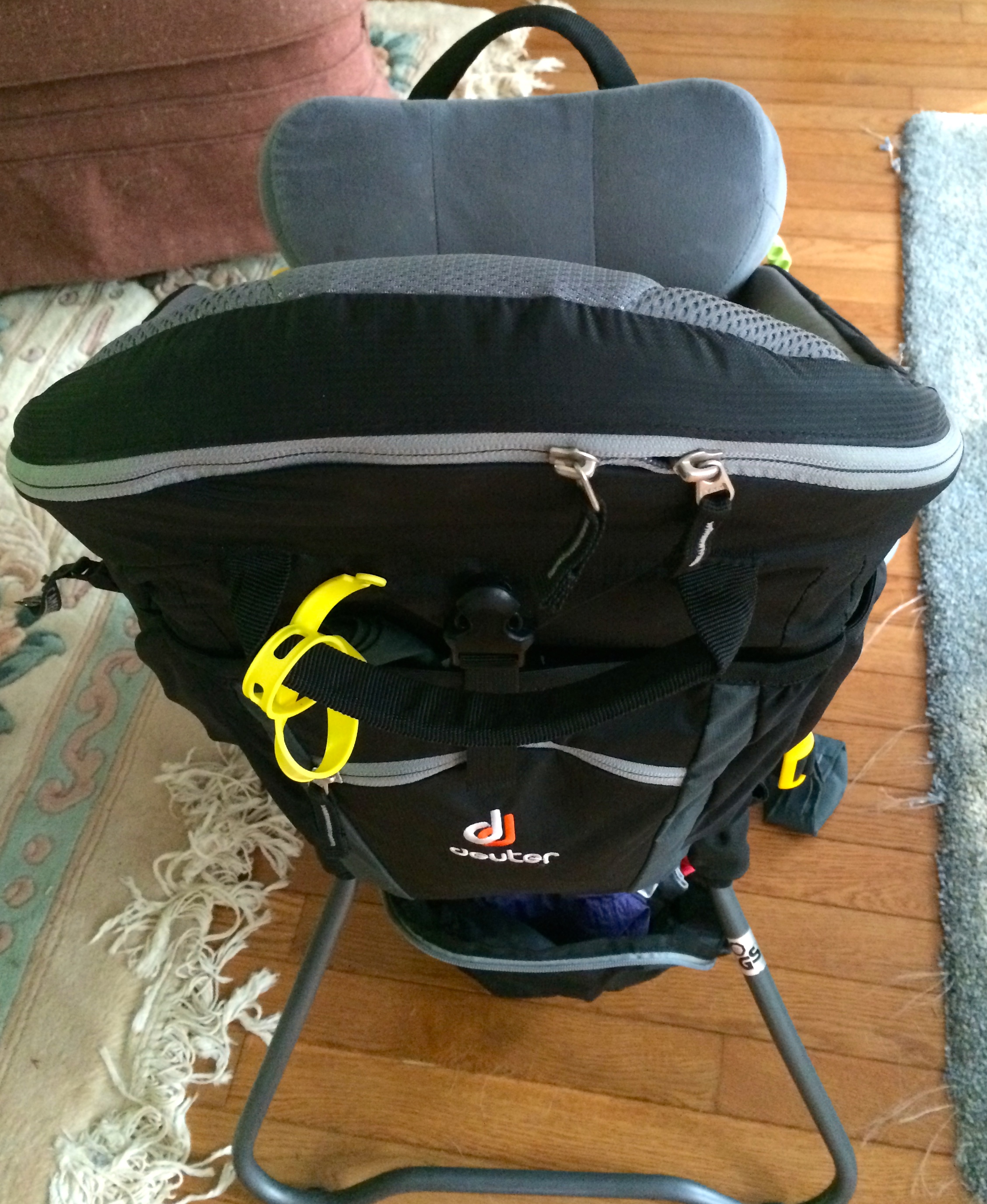
I am borrowing Deuter’s image of the Kid Comfort III. My pack is loaded out for hiking and I don’t want to get you confused on what is part of the pack and what is not. And yes, you get the teddy bear shown, red bow and all.
Kid Comfort III
Okay, let’s get down to business. Here are the changes from the Kid Comfort II to the Kid Comfort III
1) The adjustment for fitting your back, sizing your torso.
Here is the old, from the KC2. The 4 loop adjustment…. A.K.A — A big PIA, if you have to change the pack between people and one is shorter or taller.
With the new, Kid Comfort III the adjustment is now found under the back padding and is a simple pull to shorten or loosen to lengthen. In addition, there is an easy sizing chart on the pack itself. When looking at the back of the pack, it is located behind the right side strap where your shoulder area would be if the pack was on your back. You can also find the location for your water bladder by finding the H2O marker on the pack and you will see the sizing chart. The sizing is done by L, M,S and on the arm strap is a line to help you line up to the correct fitting. Depending on your load, elevation gain or loss, and as your child grows you may need to adjust it. So, don’t get stuck on a setting.
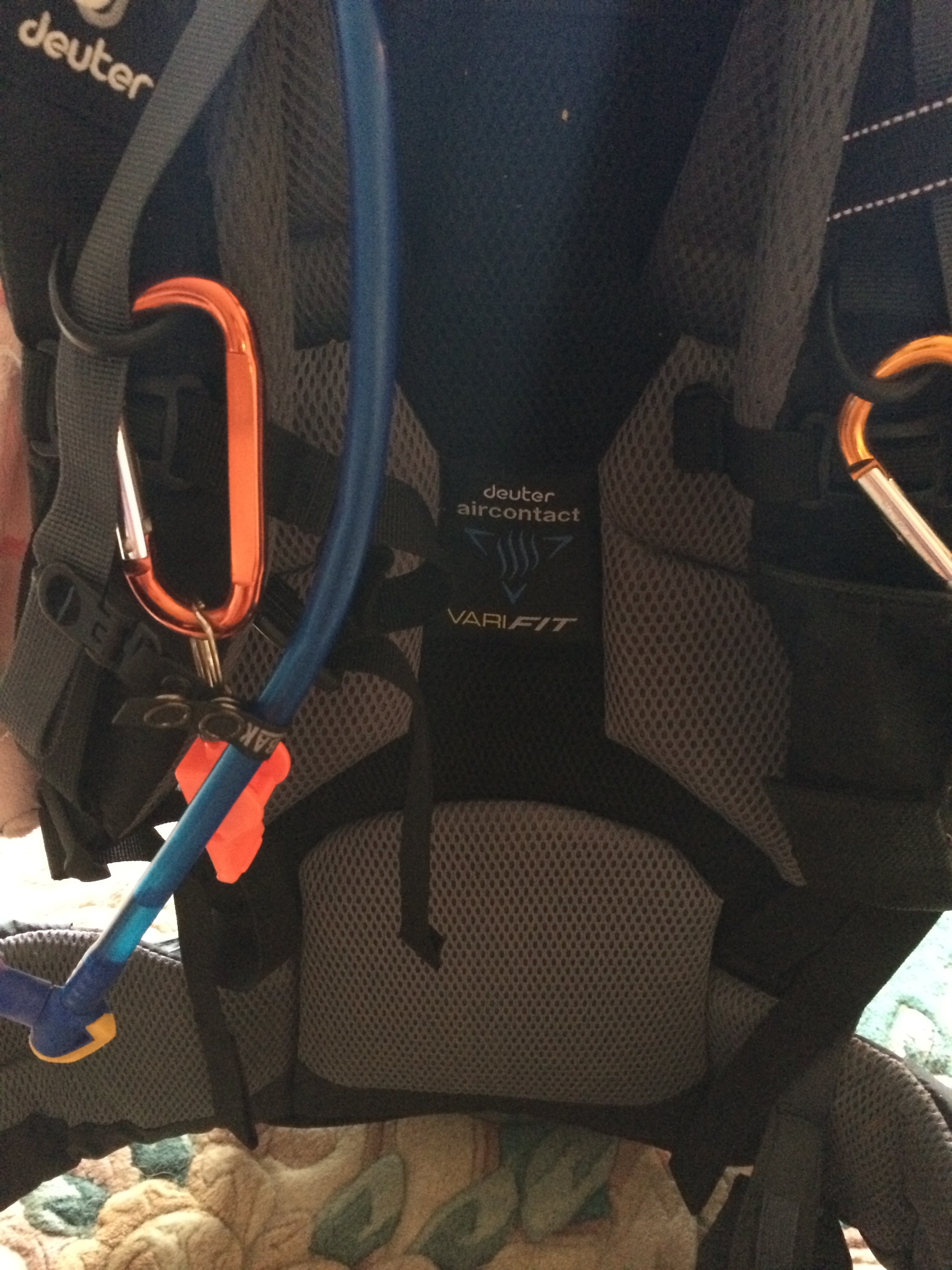
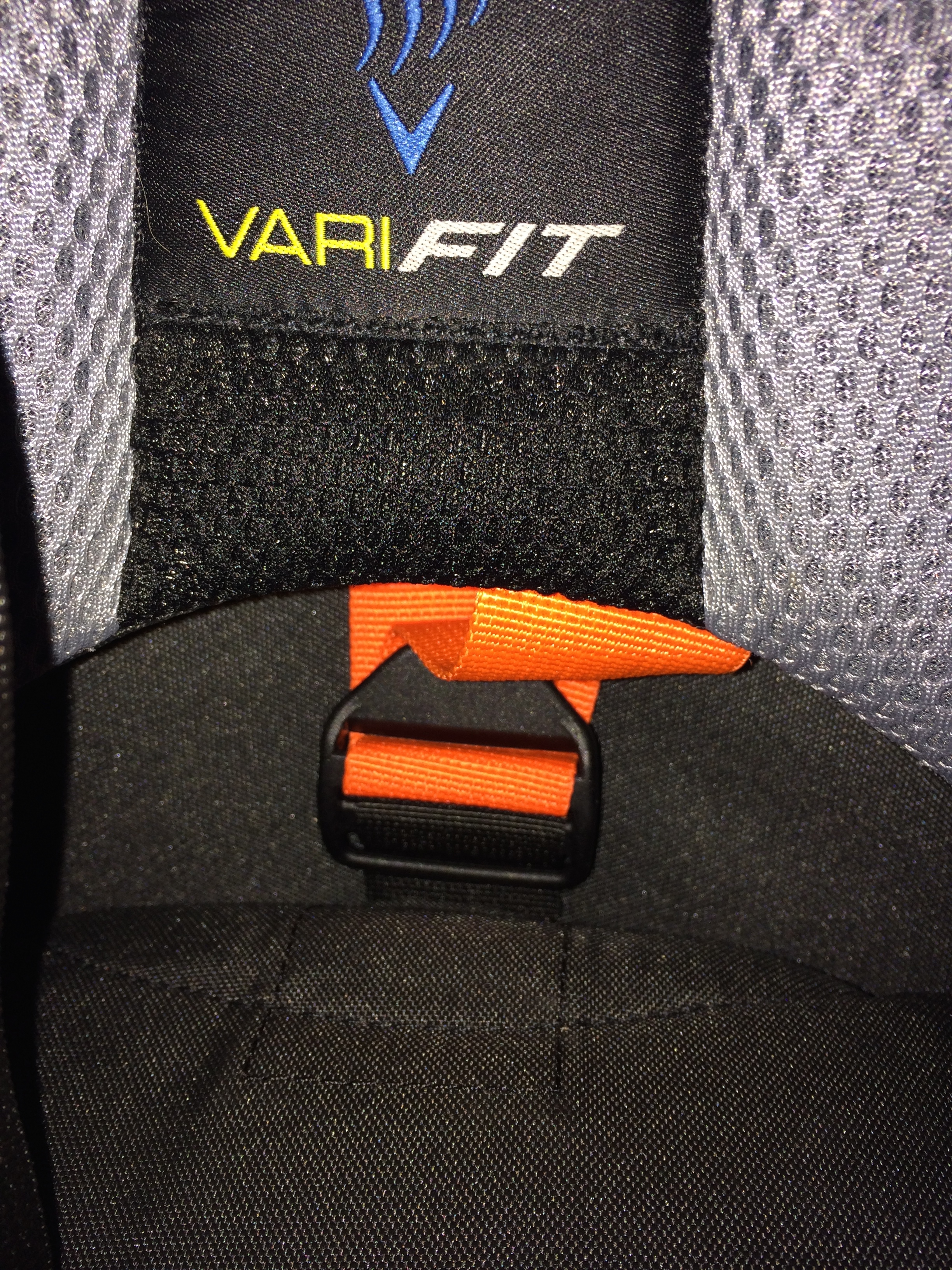
Here is the back padding on the KC3
Back padding (excuse the whistle , water tube and carabiner clips)
Right below the “VariFit” is the location of the strap. You flip out the padding and find the orange strap that you will loosen or tighten. The padding is connected to the pack with velcro.
Here is the sizing marker. As you can see the shoulder strap has the marker (white line on the left) and the sizing chart is on the right.
Another view of the sizing. As you can see, it is located near your water bladder.
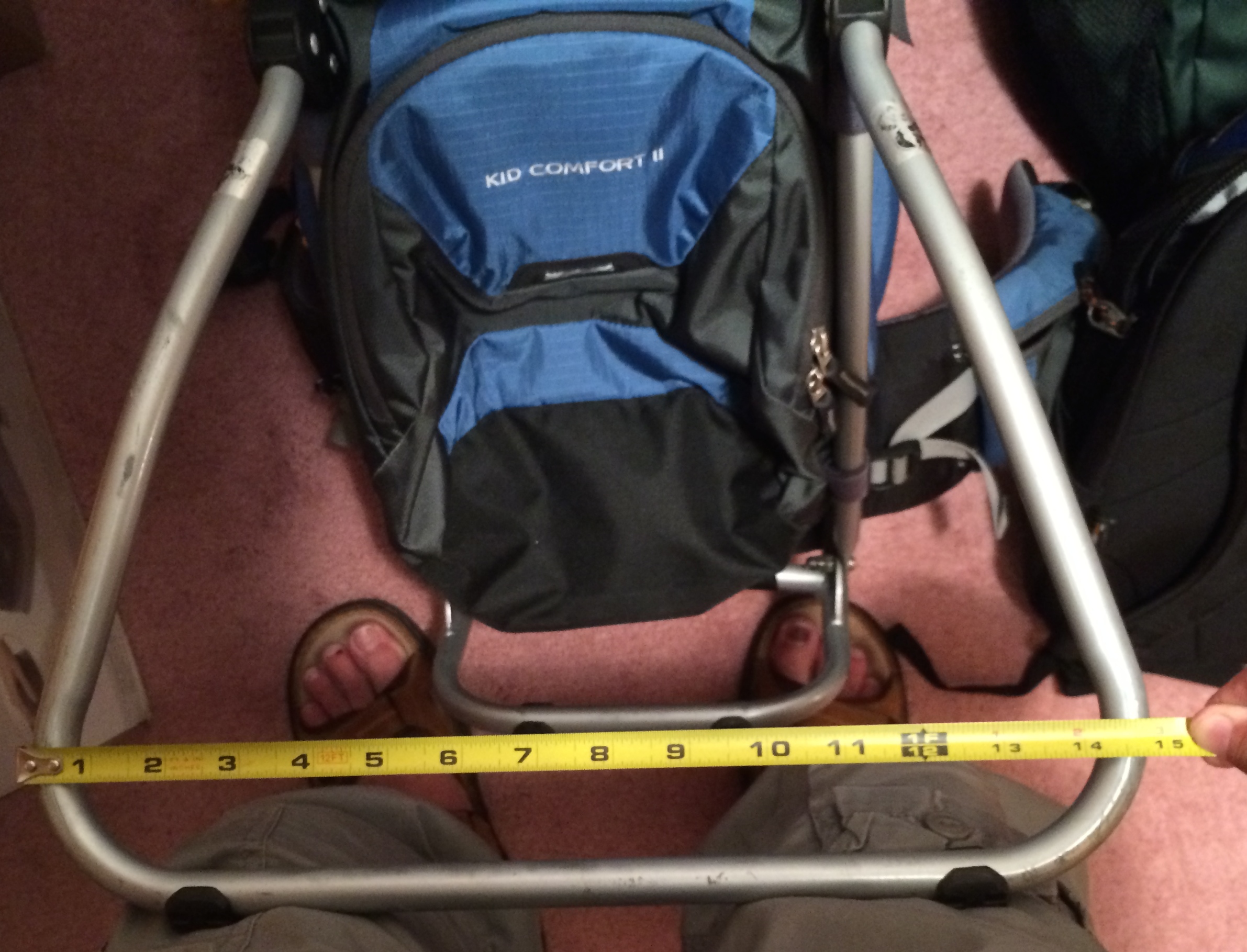
Next up, the kick stand. The Kid Comfort II (KC2) is more square and does not have as wide of a base as the Kid Comfort III (KC3). This is important just for stabilizing the pack on the ground. With our Kid Comfort II, we always had to help stabilize the pack for M to get in. Now, with the Kid Comfort III, M can easily get in and out without trouble.
The images below show you the distance between the KC2 and KC3. The KC3 is about 2 inches wider.
Kid Comfort III 16.5 inches wide.. Please, note their is an addition pack in this picture connected to the KC3 that does not come with the carrier)Kid Comfort II 14.5 inches wide
Some other differences…
*Note: These are not in any order*
The front pocket of the KC3, which is located underneath your child’s seat is larger than the KC2. This is helpful in many ways, but mostly for weather changes preparedness and/or longer hikes. Do note this does depend on how well you pack.
KC2 had only one pocket on your waist bucket. With the new KC3, there is one on each side and you get a mirror in one pocket. We still use our own. Simply because I can connect the mirror to my carabiner clips for easy access or quick ‘put-away’. It is a nice function to have. You can pack snacks, iPhone, mirror and other items you want on hand into these two waist pockets.
The Sun Shade on the KC2 was detachable. This I hated!! We ended up either packing with J’s gear or placing it on the carrier even when we were not using it. Below is the picture to help you understand the old way. In the KC3, it is part of the carrier, it is located in a zip pocket right behind the child. Unzip the location and pull it out then when you are done with it tuck it way. No swing strings, no child trying to pull it.
Old way, you can see the shade cover hooked up, but not being usedZip pocket – Location of Sun Shade
The KC3 comes with foot stirrups for your child, the KC2 did not. This is wonderful! Your child will have their feet secured and stable. This makes them feel more comfortable. No more swing feet, no more getting kicked. I have received many comments on this one key thing on the Kid Comfort III. It’s purely a blessing!
The KC3 allows you to adjust the child resistant straps at the shoulder. As your child grows you can move up the straps. In addition, you can lower the seat of your child for growth or comfort. There are two locations to do this. First, is on the side of the seat and the other is in the front of the child’s seat. The adjustments are very simple, normal loop system.
The upgraded chin-pad, you can see it here at this, link. This pad can be is easily removed for washing. There are two snap buttons in the front and two loops to connect it to the pack in the back. We love this upgrade. It has helped keep our daughter’s head more stable when she sleeps.
Sleeping on the chin pad
The below image shows you the sun shade, foot stirrups, chin pad. Please, note, the sun shade is not in place, this was during our lunch break and M fell asleep. We did not want to wake her.
Napping on Carter Dome
One major point, I give to the Deuter Kid Comfort is the side buckle, which allows for side entry. It is a small, but important item that all Deuter Kid Comforts offer. Our daughter loves hiking with us, this side buckle allows her to climb in when we are ready to go and out when its time to walk around. Yes, there are times we have to ‘put her in’, but that is only about 5% of the time, the rest she goes willing. Other carries, do not have this option. This buckle is not easily opened by a toddler. It locks in similar to a seatbelt clip.
Miss M has been known to climb in the pack when I am cleaning it or packing for a hike.
Sneak in her pack to play
As we did with the Kid Comfort II, we connected a camel back waist pack to the back, so M has her own water source. This does add the weight to the pack, so be wary when doing this. This is the only issue I have will ALL child carriers used for hiking. There is no location for your child to have their own water source. Yes, most packs have a 2 Liter area for a bladder. But this means you and your child will need to spilt it. Two liters of water can go quick on a hot, humid, or harder trail.
In addition, we place Nuun in our water for electrolyte replenishment. Since, M isn’t doing much work, she doesn’t need them. Nuun is another recommended item for hydration. Unlike, Powerade, Gatorade, and other sugar filled hydration fluids, Nuun uses no sugar, no carbs it’s a great hydration source. Oh, as a suggestion, don’t use the Strawberry lemonade, it’s the only type so far we do not like. And my husband loves Strawberry lemonade.
If you have any questions or areas you would like clarification on. Please, don’t hesitate to reach out to me.