Mount Osceola is a 4,315-foot peak, located in the White Mountain National Forest, New Hampshire. Mount Osceola is named for the early-19th century Seminole leader.
There are two ways to reach the summit of Mount Osceola. One is from Greeley Pond Trail to the northeast of the mountain, which requires crossing the East Peak of Osceola first or from Tripoli Road to the south. We took the southern ascent via the Mount Osceola trail, which is a 3.2 mile/5k trek to the top, 6.2 mile/10k round trip.
The trailhead is off of Tripoli Road in Waterville Valley, NH. You can access the road off I-93 exit 31. *Note: this road is closed from November to May* Travel roughly 6.7 miles on Tripoli Rd to the trailhead. The trailhead is located on the left with parking. *There is a fee for parking for those that do not have a yearly parking pass.*. Tripoli road is paved then becomes a gravel a few miles into the woods. You will pass various camping grounds during the summer it is rather busy so be cautious.
Trailhead sign
The trail is one of the easiest we have done. There were not many areas that would be problematic for a family hiking with a child. It is a far cry from the ‘death match’ hike of Mount Carrigain, via Signal Ridge Trail. There are a few areas near the summit that you will enjoy a few views and good breezes. In addition, compared to Mount Carrigain the trail path is not so rocky and a good 3 feet wider in certain areas, which is helpful when allowing people to pass.
Here are some images along the trail to the summit.
Abby on the trailAbby on the trailThe girls on the trail
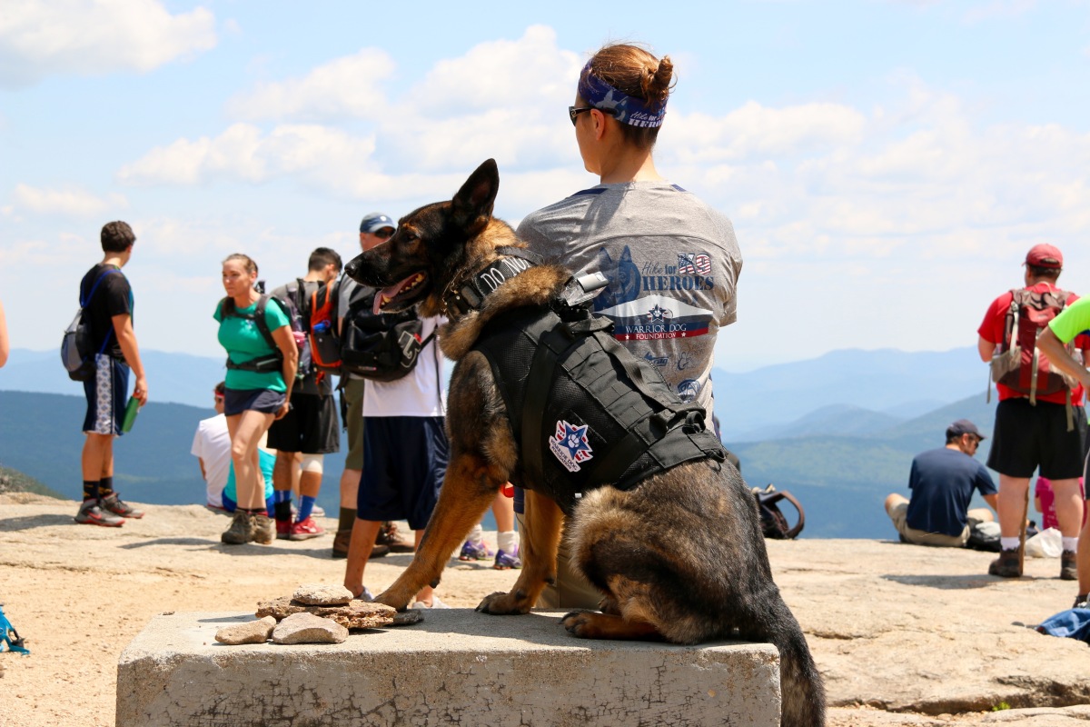
Our objective with this hike was to train Abby, our rescue canine. This trail is busy, very busy with people and dogs. The climb is rather easy but all the traffic of people and dogs is a great way to solidify training. There were “reactive” dogs on the trail, which was very helpful for training and a few people who were terrified of dogs. As I said, the trail is very busy and wide, which is great for real life training.
The trail is rather straight forward, a basic up and back with a few switch backs to keep the incline easy to handle. Some part of the trail are under reconstruction, but there are no hurdles to worry about.
Trail reconstruction sign
As you approach the summit, you will face some rock facings. A few of the facings the incline is rather step and can be very hazardous when wet. You can either go hand over feet or work your way along the side and up. I highly suggest to plan accordingly.
As you approach the summit there is a path to your left, climb up the rock and look out. You will be able to see Mount Washington and the Presidential’s on a clear day. Double back and take the path to the summit. The path to the right on your approach leads you to summit, too. We suggest skipping that path the approach from the path straight ahead is way better.
We were not able to find the summit marker for this mountain, but normally with fire tower mountains, we have found there are no summit markers.
If you are looking for an easy up and down with beautiful views this is your mountain. If you are hiking with kids it is definitely something you can do as a family and if you are traveling with a child on your back, it’s a walk in the park compared to other White Mountain trails.
Here are some summit images…
As usual, please remember to leave no trace especially in areas where bears are more prone. Safety first.
End of the year is here, if you can, want to or need to keep Uncle Sam at bay.
Please, donate to one or both of my favorite nonprofit organizations. I have no ties to either. I support them for the work they do and I believe in what they do.
MWOBS studies the weather and does many climate research projects to help give us warning of storms which helps protect what we love. Mt. Washington is known for the worst weather in the world with winds reaching 231 mph. Find out more at http://www.mtwashington.org, here.
Warrior Dog Foundation, is a home for SFO (Special Forces Operation) dogs. They help find a dog home after their service or injury. They work directly with the dog, house them, give them whatever care and training needed. They do all this with the honor the dog deserves. They provide a permanent home for dogs that cannot make the transition. Find out more at http://www.warriordogfoundation.org, here.
First off, I want to say congratulations to everyone that helped make “Seek the Peak” such as wonderful event. We enjoyed our time on the mountain and had a wonderful time that the events put on. So, thank you. We will definitely to do it again next year. And to all those that donated, thank you!
I recommend this event for any hiker looking to be part of something, this is a great event to take part in. You can check out more about “Seek the Peak”, here
Here’s a quick rundown of the event;
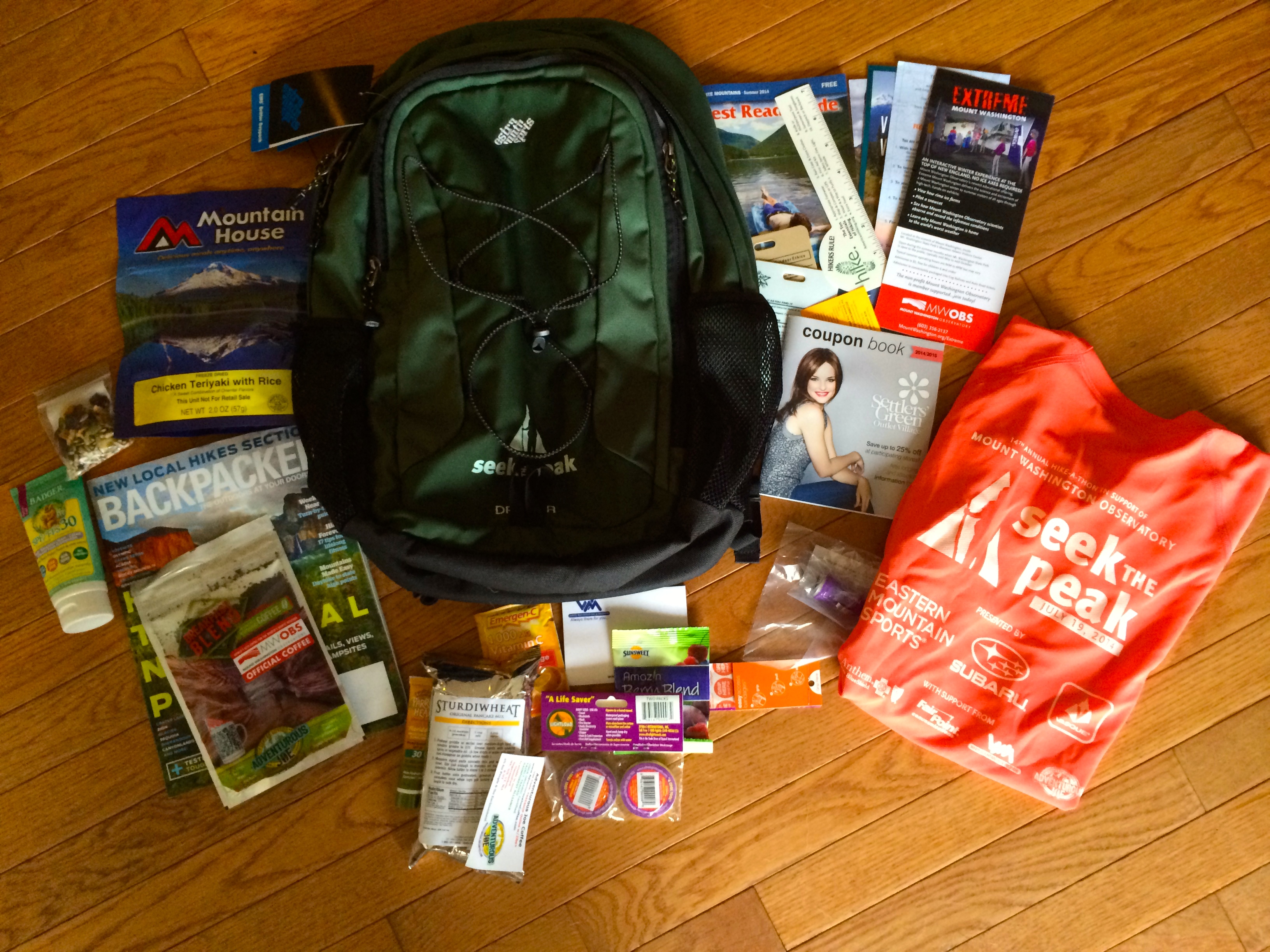
The night before your supported hike, you get to pick up your goodie bag if you meet the minimum goal of $200.00, similar to that of a runner’s packet for race, but this goodie bad is loaded.
Goodie Bag from Seek the Peak
When you pick up your bag, you will have the opportunity to spend time at the Mt. Washington Observatory Weather Discovery Center, have some food and meet with seasoned hikers to help you decide what trail is best. It’s a great Kick-Off Party. You will be asked about which trail you plan to take and reminded to sign in and sign out at the trailhead with the “Seek the Peak” personnel.
The after-party is the same day of the hike and located on the east-side of mountain in the Mount Washington Auto Road entrance. This is the place with free food, raffles, vendors, etc. Just remember to bring you wristband that you receive when you pick up your goodie bag. 🙂 We didn’t spend too long there, since we had our daughter. After a long day of hiking, it was time for downtime and bed.
We decided to travel up the west-side of the mountain to the summit via “Jewell Trail”. The Jewell Trail is one of the longest trails up Mount Washington. You can find some more information on the trail, here. It is one of the easiest trails up to the summit, but we find it also the safest. An added benefit is that we have hiked this path before if poor weather or clouds came in, we had a good understanding of the terrain.
The trailhead starts across the tracks of the Cog Railroad. This is one of the other benefits of hiking this trail, if needed you can take the Cog Railroad down to your car. It is a little pricey, $45 per person, but worth it. Just remember to bring some cash with you. There is an ATM, but it does run out of money. 🙂 The Cog Railroad is another great piece of history for the Mount Washington area. Here is a link to their website. You can use that site for directions to the trailhead.
The Cog Railroad, Jewell Trailhead
One of the big changes, that I love with using this trail is that parking for hikers is now free. As you approach, the Cog Railroad you will see a sign for “Hiker Parking”, use that. If you drive up to the Cog, you will have to pay for parking. You can looking at a 3 to 5 minute walk depending on your pace to the trailhead.
Again, the trailhead starts across the tracks, look for a staircase going down and cross the tracks. Just look out for trains. 😉 The first thing you will have to do is cross the Ammonoosuc River. It’s easy, just use the bridge. You will start climbing rather quickly, but at a moderate incline. Around the first mile, you will cross over Clay Brook. The climbing up is rather easy, it’s a good workout but not strenuous. When you start your first switchback, you are about half-way to breaking the tree-line.
Heading up the Jewell Trail
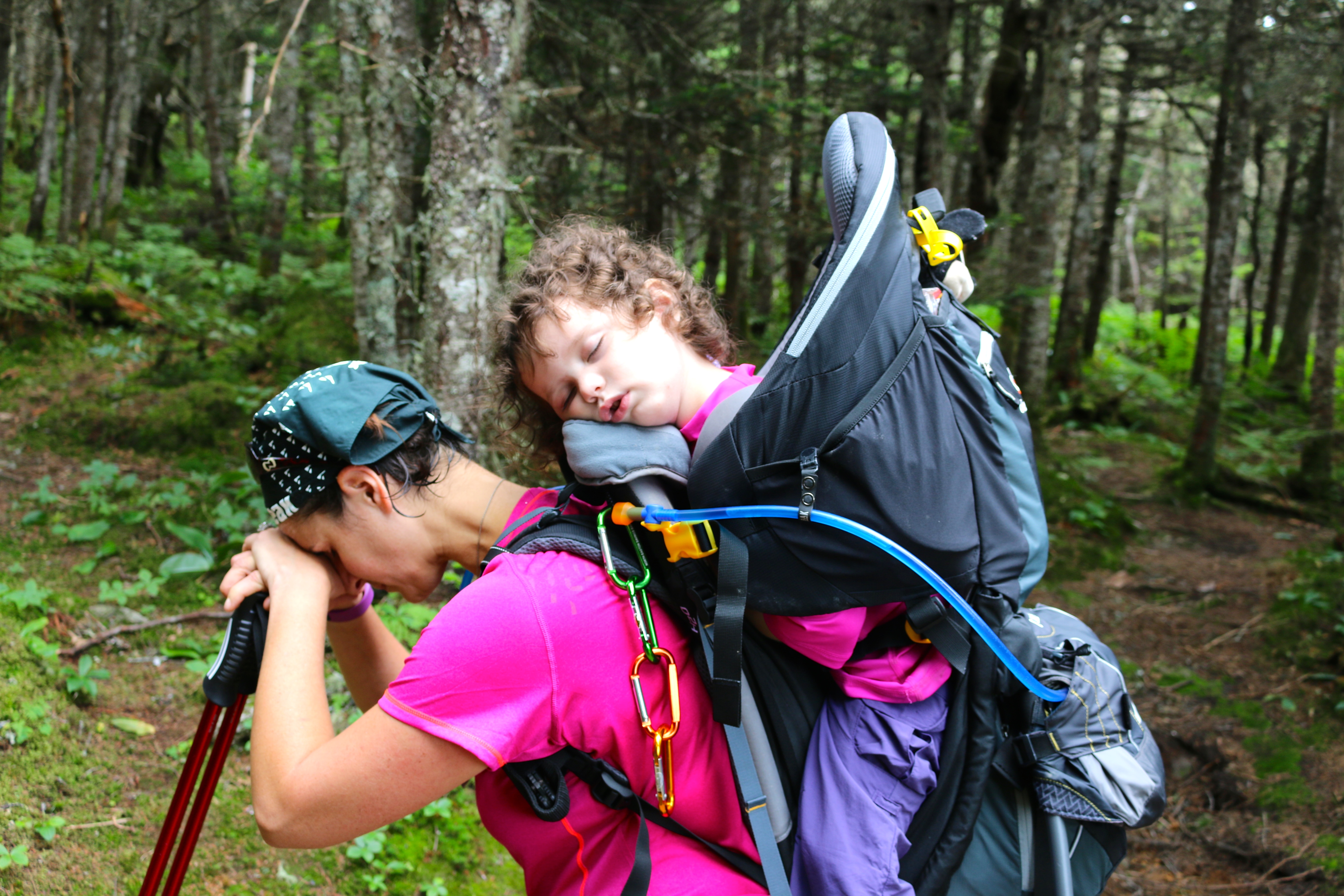
As you approach, you will know you are about to break the tree-line when you see a nice little area on your left with a log bench and small fire pit. This is a great location to stop and take a break.
Break time for Mom & Nap time for M
I may look pretty tired, but I am actually getting focused for when we break the tree-line. I have a love-hate relationship with spending time above the tree-line. Minus the direct exposure to weather, I have a little trouble with heights. Yes, I know one would figure I would find another hobby. Well, that’s not me, I am the person that takes my fears head-on. This is one way to do it and its step one in the process of reaching my goal.
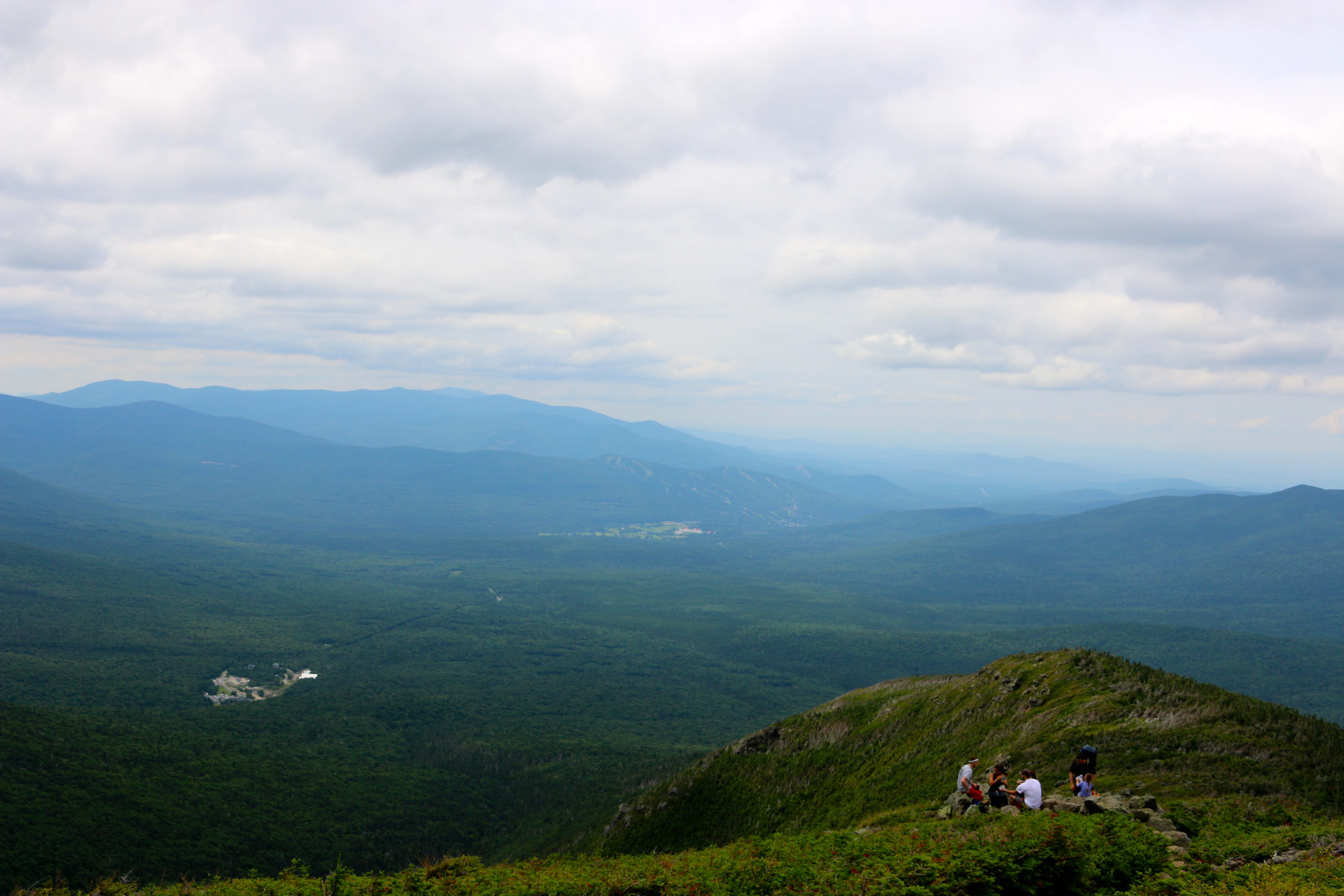
When you break tree-line (around mile 3) you will get to see Mount Washington to your right, it looks like it across the way, it is, but you have a few more miles of climbing before you are standing on the observation deck. For your second view, you can turn around and see the Cog Railroad, where you started.
View back down to the Cog RailroadM & me with Mount Washington in the distance
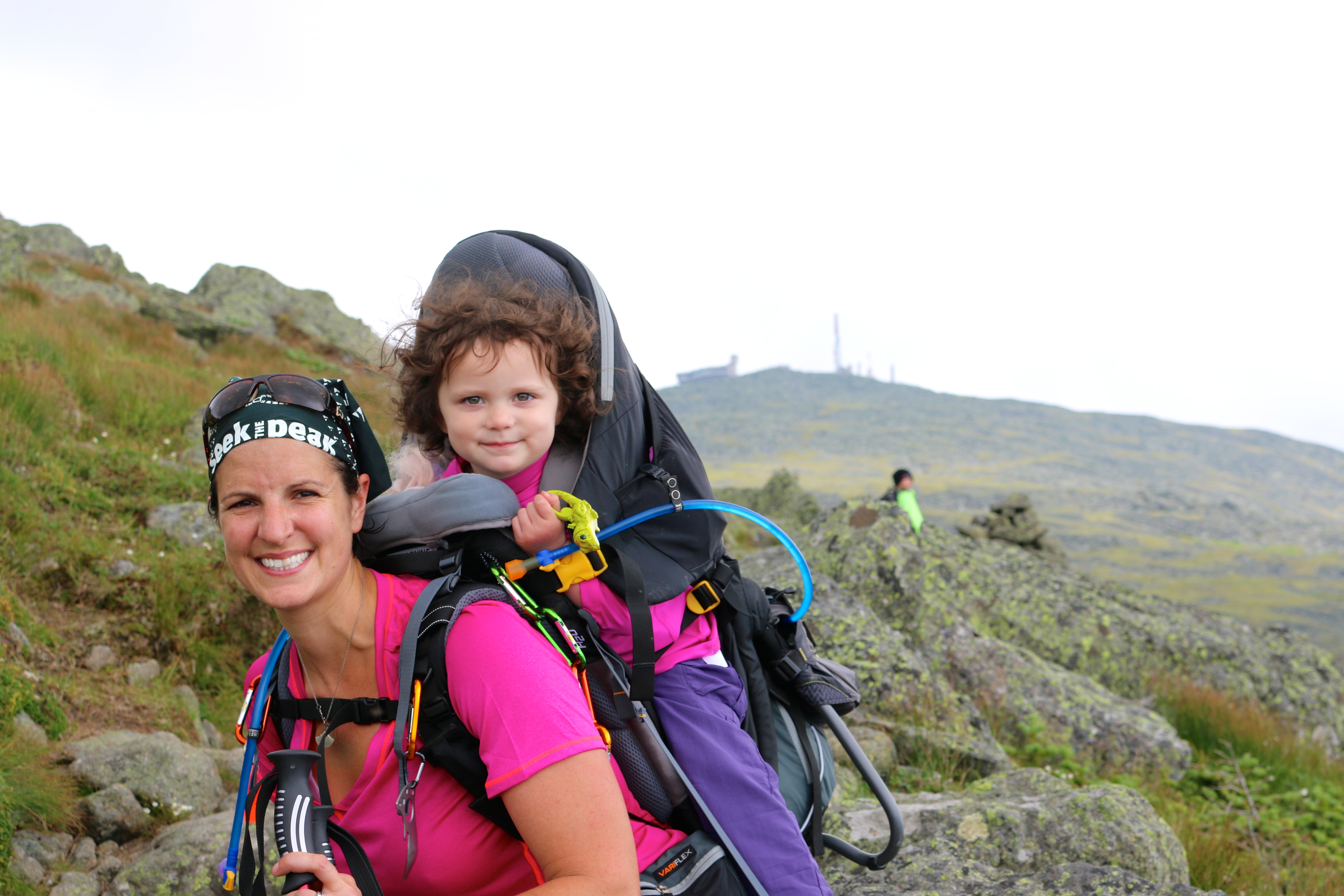
This section of the trail is rock to rock, with some small areas of earth path. Keep to the trail by following blue trail markers and cairns, also read your trail signs. The Jewell Trail will “end” and you will follow the Gulfside Trail (AT = Appalachian Trail). There is a nice large flat-ish area after the Jewell Trail ends and you pick up the Gulfside Trail its about 0.3 miles from the end of the Jewell Trail. Below, is the trail junction sign, this is where we let M out to play for a bit. Excuse the bee, M decided to bring it along this with “Navigational” Pony this hike.
Trail Junction Sign, location of playtimeView from playtime area to Mount WashingtonM practicing with Dad
There are few paths you can take to get to the summit. We took the Gulfside Trail then followed the Cog Railroad up to the summit our first time. This time we followed the Gulfside Trail, crossed over the Cog Railroad and connected with Crawford’s Path and up to the summit. The views looking out from the trail are amazing.
View over my left shoulder
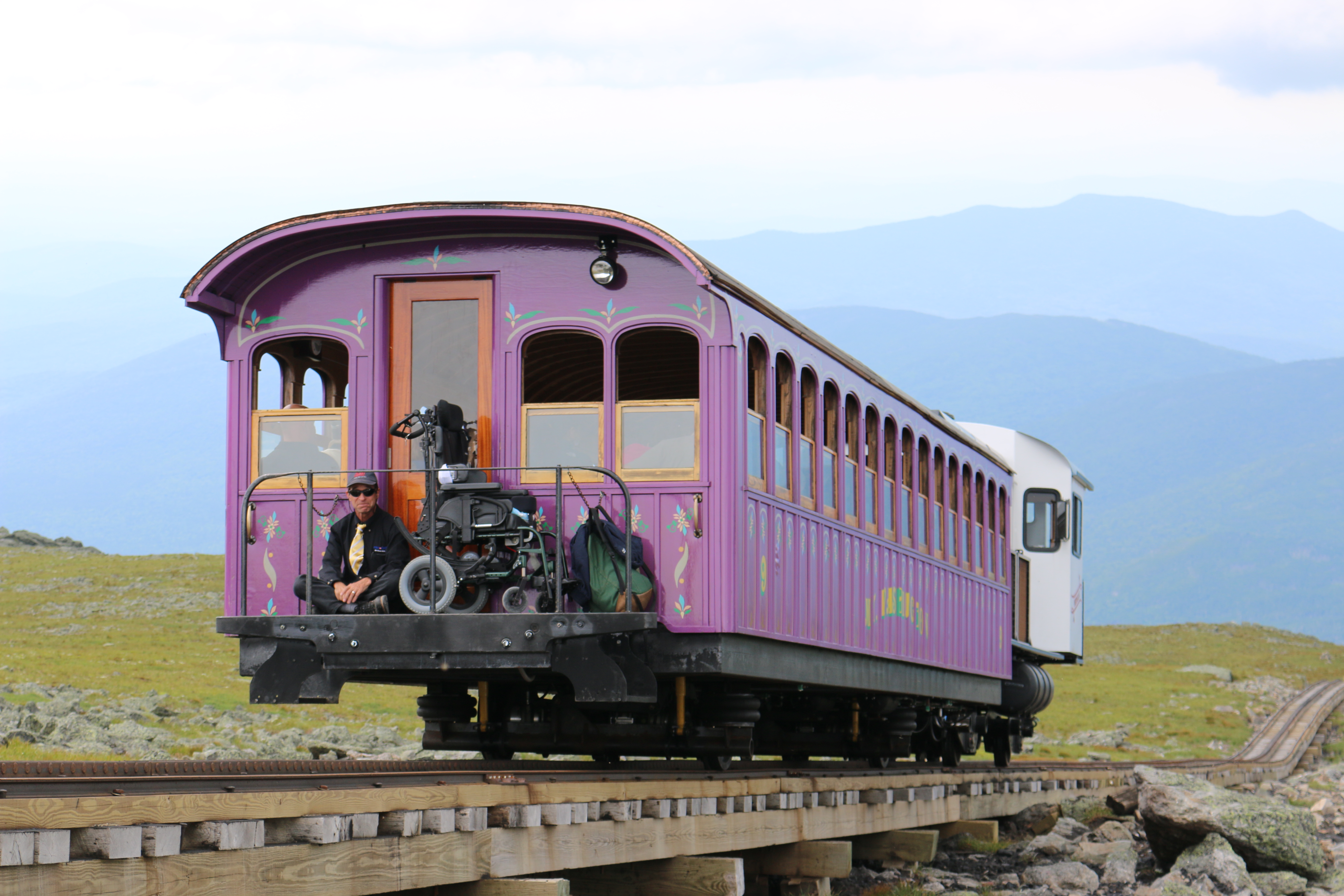
As mentioned, you can hike along the side of the Cog Railroad or across over the tracks. Just be aware of the trains.
Cog RailroadCog on its way down
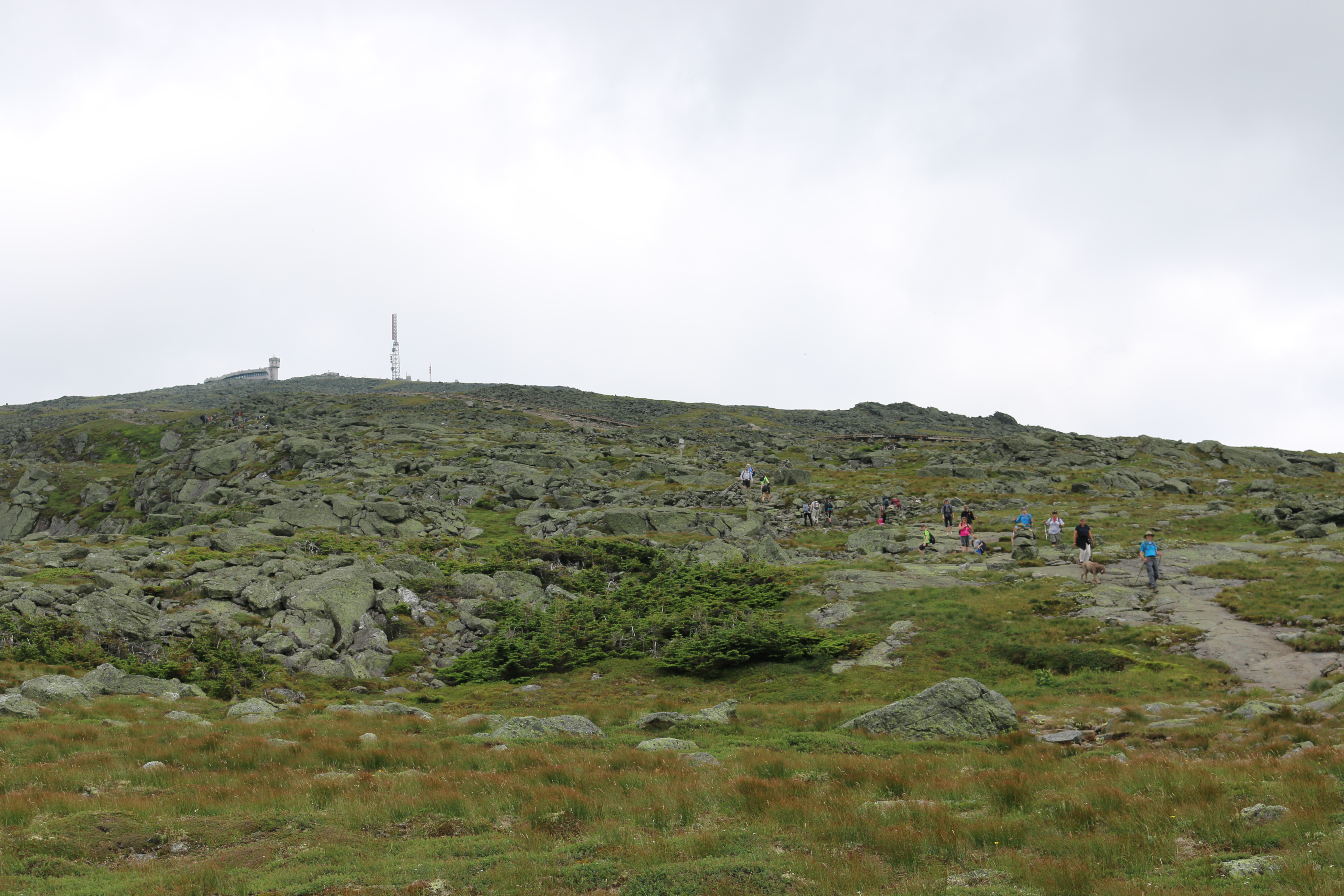
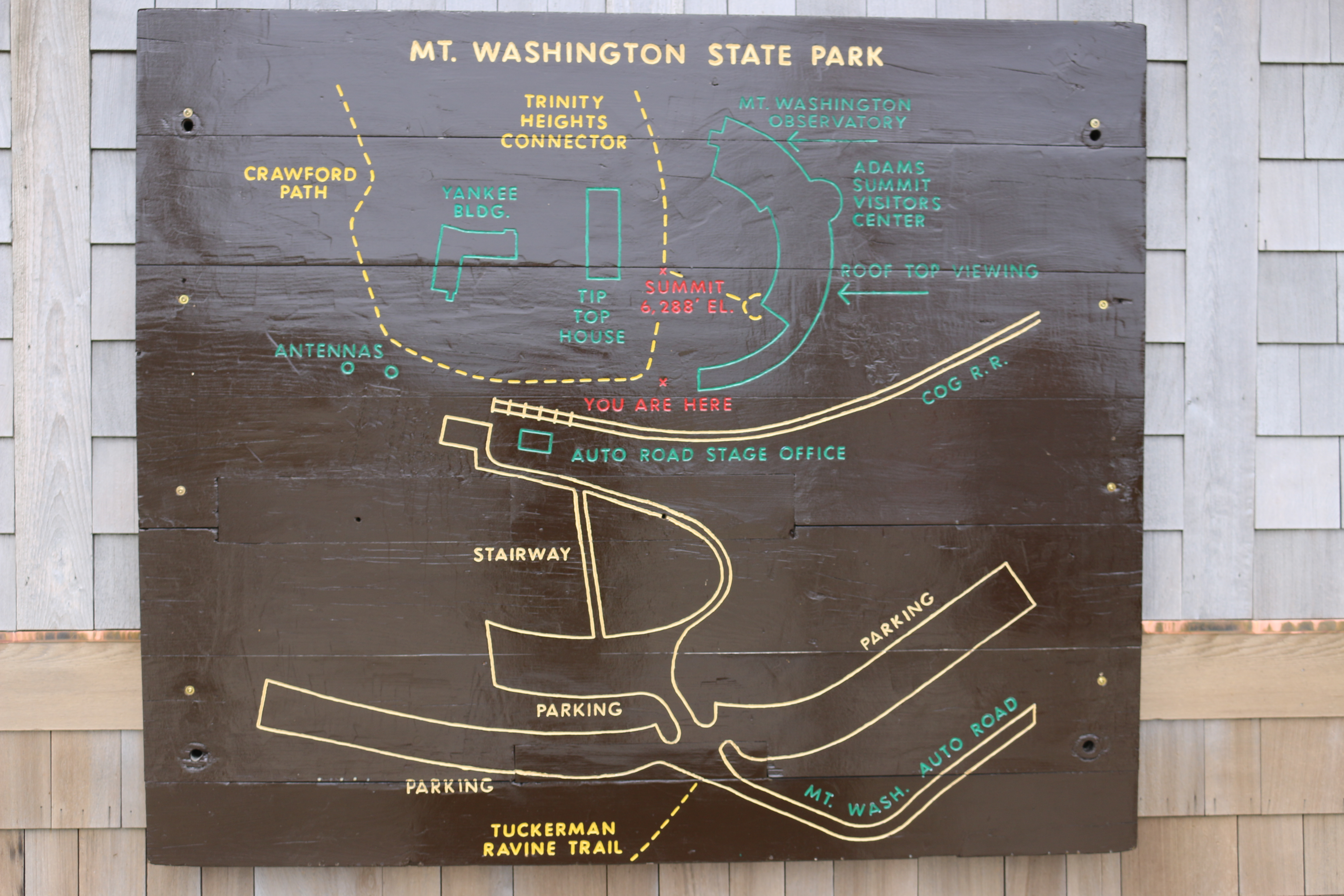
At the summit of Mount Washington there are various locations to see and do, such as, the Tip Top House, Sherman Adams Building, stop by the Observation Deck, of course get your picture at the summit post. The Sherman Adams Building is where you will find a gift shop, cafeteria, Post Office, bathrooms, location to purchase your cog ticket (if needed). Some areas at the summit are under construction, but this does not affect what they have to offer. You can find more out at this link.
Here are some images for the summit
Crawford Path MarkerMt. Washington State Park Map
Just a closing note, inside the Sherman Adams Building you will see a wall that lists out the causalities on Mt. Washington. You may start your hike on a clear and sunny day, but half way through or during your time at the summit a front or low clouds may come through. Please, check here for Mt. Washington summit weather. You can also find a weather report twice an hour on New Hampshire Information radio station, 95.3 FM.
No matter what, be prepared for anything, have plans and routes for bad weather or injury. Be smart, you don’t want your name added to the list. Plan smartly.


